Posted: Tue Jul 16, 2019 3:07pm
The Mar Menor effectively has no tides, although there is some movement largely related to air pressure changes.
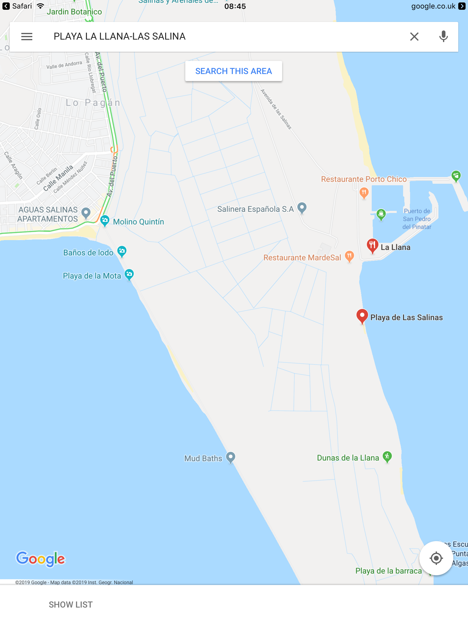
In the map extract that you posted, the MM is to the west (left) and the Med to the east (right). The Med has some tide (but not a huge range). The Salinas stretches from El Mojon in the north, to the tip (Punta de Algas) opposite La Manga in the south. There is continuous beach on the Med side (except for the Marina de las Salinas). This shows up well on Google Maps with satellite mode (but the 'map' mode is a bit misleading).
Various parts of this continuous beach have different names e.g. Llana, but this is somewhat artificial and almost impossible to see as differentiated on the ground.
These beaches can be reached from San Pedro/Lo Pagan:
- drive/cycle to El Mojon and walk along the beach
- drive/cycle on the road across the Salinas to the Marina and then walk/cycle along the beach
- cycle/walk along the promenade from the Molino Quintin (Paseo en San Pedro Del Pinatar) past the Molino Calcetera and on to the Punta de Algas, and then cycle/walk along the beach
This latter option is popular, but I have never seen the beaches at that end of Salinas busy. Some walk/run/cycle a loop out to the beaches by one route, along the beach, and then back by another.
To cycle from Molino Quintin to a place on the beach can take less than 15 minutes, and at a gentle pace no more than 30.


 My name's Alex and this is my website all about Lo Pagan in Spain. Register now for free to talk about Holidays in Lo Pagan and much more!